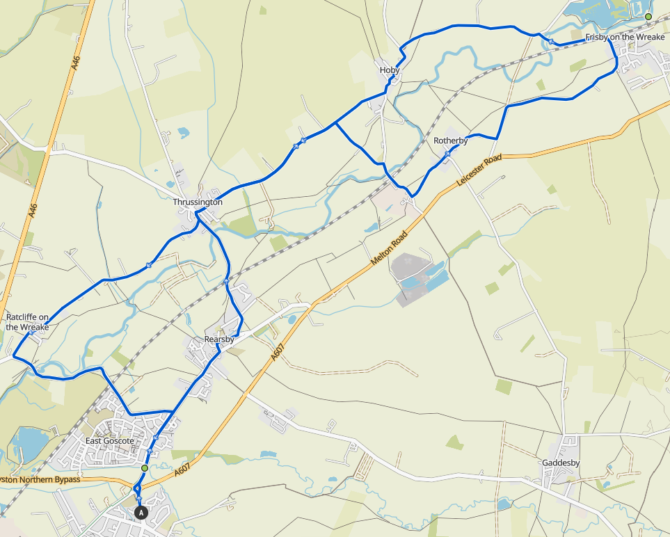
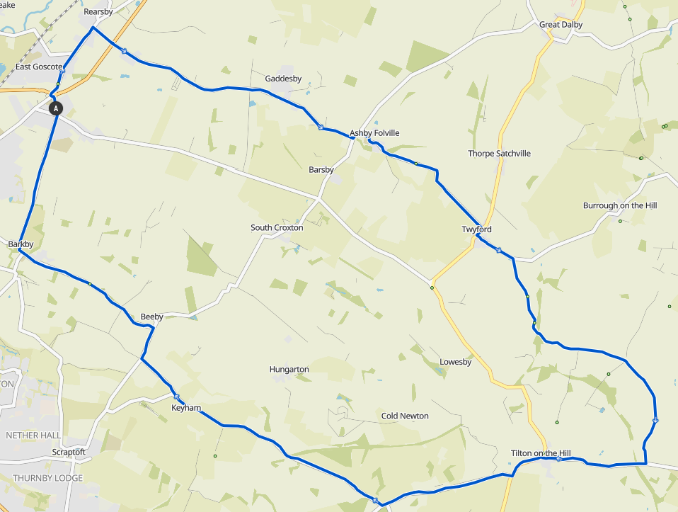
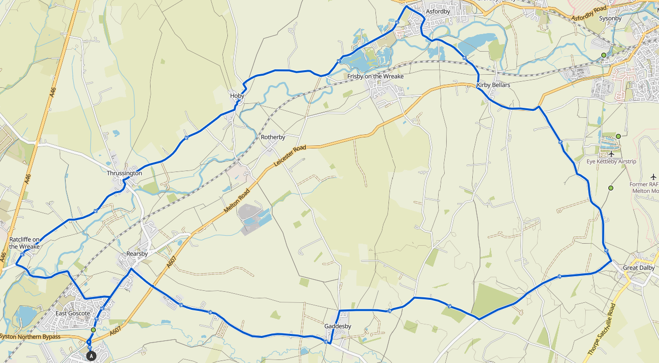
Week 25: Thrussington
The final ride of the year! It's over so soon.
A Group:
 21.8km / 13.5mi / 120m Elevation
For the final time this year, turn right out the village hall and go straight over the roundabout to Rearsby. Turn left at Bears…
The final ride of the year! It's over so soon.
21.8km / 13.5mi / 120m Elevation
For the final time this year, turn right out the village hall and go straight over the roundabout to Rearsby. Turn left at Bears…
 27.3km / 17.0mi / 180m Elevation
Turn right out the village hall over the roundabout to East Goscote, then straight through to Rearsby and turn right after the pub to cross the A607 through the small lane (regroup h…
 32.2km / 20.0mi / 270m Elevation
Start left out the village hall, straight over the crossroads, and then left onto Ridgemere Lane at the top of the hill. Follow the Ridgemere onto Syston Road, then turn right onto C…
 34.8km / 21.6mi / 280m Elevation
Go left out the village hall and straight over the crossroads, then up past the rugby club to the traffic lights. Go straight across the traffic lights and into Barkby. Turn left at …
 37.7km / 23.4mi / 350m Elevation
Turn right out the village hall to East Goscote, and left down Broome Lane. Follow the road around at the end of Racliffe on the Wreake and go under the A46. Turn left at the top of …
 42.4km / 26.3mi / 240m Elevation
Start by going right out the village hall, to East Goscote, then Rearsby, and left onto Brook Street in Rearsby. Go left up Station Road and over the railway lines into Thrussington.…
 40.5km / 25.2mi / 400m Elevation
Go right out the village hall to East Goscote, and turn right again after the pub in Rearsby down the small lane over the A607 onto Gaddesby Lane (regroup before crossing)
Fol…
 40.5km / 25.2mi / 400m Elevation
Turn right out the village hall to East Goscote, and left down Broome Lane. Follow the road around at the end of Racliffe on the Wreake and go under the A46. Turn left at the top of …
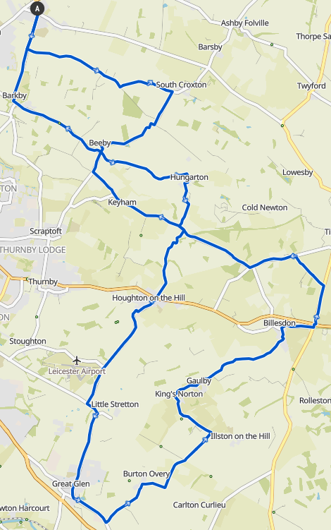
This week is the week we race downhill without pedalling as far as we can. The race starts at the top of Strawberry Hill (between South Croxton and Beeby) in the layby at the top.
Riders set off at 15 second intervals and roll as long a distance as possible, you then wait at…
 61.2km / 38.0mi / 430m Elevation
Go right out the village hall, and over the roundabout to East Goscote. After the pub in Rearsby turn right up Gaddesby Lane and through the path to cross over the A607 (regroup at t…
 55.0km / 34.2mi / 470m Elevation
Left out the village hall, straight over the crossroads, and left onto the Ridgemere at the top of the hill. At the end of the Ridgemere before South Croxton, turn right up Croxton R…
This is an off road ride for intermediate skilled riders. You will need moderate bike handling skills to do this route, but if you're unsure come alone as there's options to cut back early at every sector.
This route has been tested and can be ridden on any cyclocross, gravel, or mountain bike.
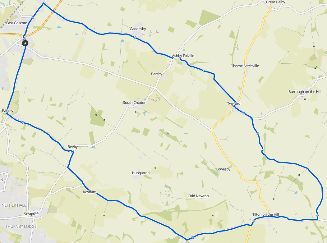
Left out of the village hall to Barkby, Beeby, then right at the crossroads to Keyham (left onto Keyham Lane), then along Ingarsby Road turn right to the back end of Hungarton on Bar…
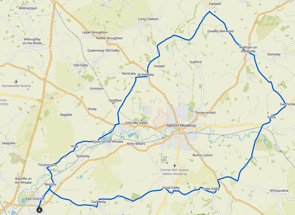
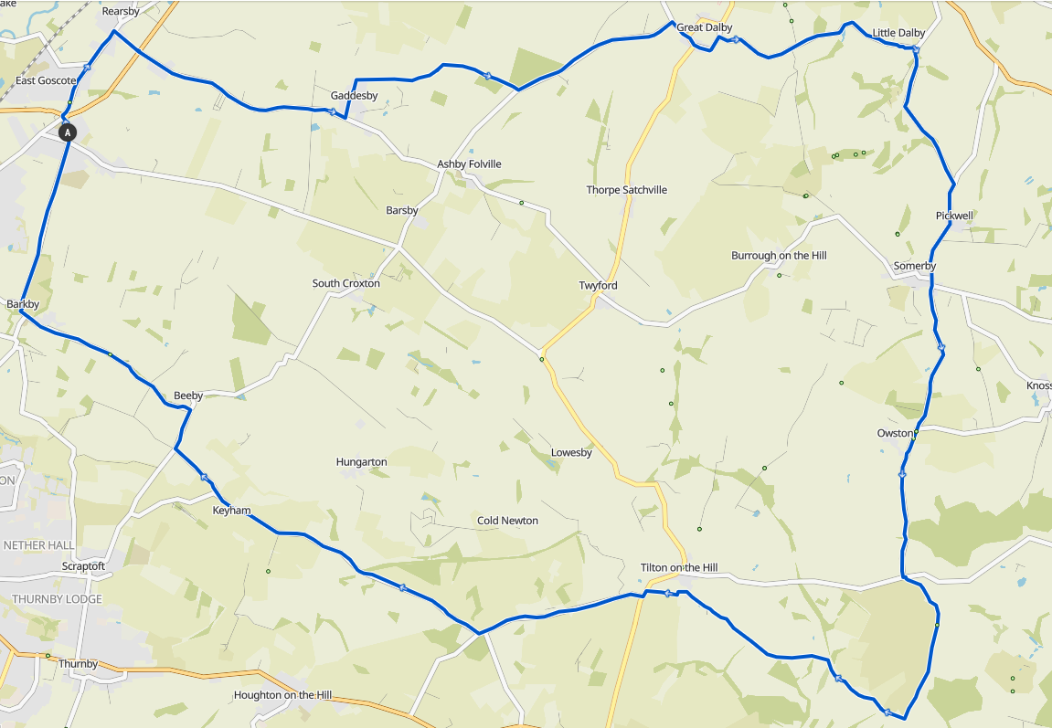
Rearsby, Gaddesby, Twyford, Borough Hill all the way to the Fort (regroup at the carpark) Broome Lane, Humble Lane to Cossington, then Sielby, Barrow, and onto Coates Road. Regroup crossing the Loughborough Road at the cut through. Rearsby, Gaddesby, Asfordby Folville, Twyford, and up Burrough Hill all the way to Somerby (regroup at the fort carpark). Continue along through Somerby to Pickwell and then the Dalb…
Rearsby, Gaddesby, up Park Lane at the Cheney Arms, then right at the top to Great Dalby, Little Dalby, Pickwell, Somerby, and Owston. Then take the Loddington Road to Tilton and reg…
Barkby, Beeby, Keyham, Hungarton, Baggrave (regrouping at the Main Road). Then over to Barsby, through the village to Gaddesby, up Park Hill and straight on to Rotherby (straight over…
Go right out the village hall to East Goscote, and turn right again after the pub in Rearsby down the small lane over the A607 onto Gaddesby Lane (regroup before crossing) Foll…
The Bash Route, apparently if you don't know it you don't need to do it ;) But I'll tell you anyway! Start by going right out the village hall, to East Goscote, then Rearsby, a…
Starting out heading down the Ridgemere to South Croxton, Barsby, and Ashby Folville, this route then runs up and down into Twyford and towards Borrough on the Hill. Cutting off part …
Turn right out the village hall and over the roundabout to East Goscote and Rearsby. Turn left down Brook Street in Rearsby and onto Brookside. Then turn left up Station Road. Follow …
Turn right out the village hall over the roundabout to East Goscote, then straight through to Rearsby and turn right after the pub to cross the A607 through the small lane (regroup he…
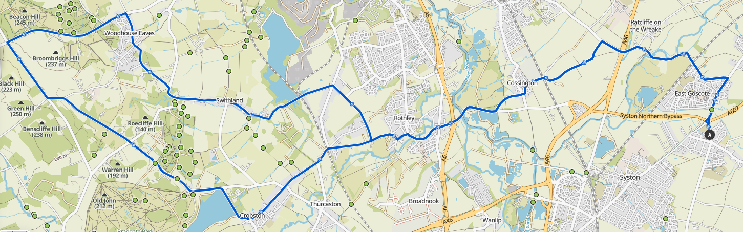
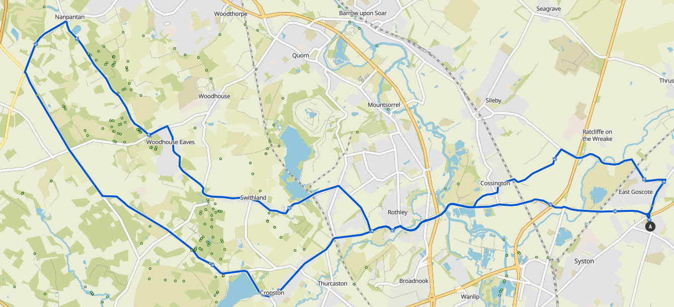
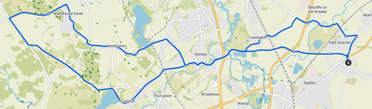
Starting towards East Goscote, then down Broome Lane to Humble Lane into Cossington. Over to Rothley and through the village. Once past the cricket club turn right up The Ridings and head to Swithland. Through Swithland to Woodhous…
Rearsby, Gaddesby, left up the hill at the Cheney Arms, then right at the top onto Pasture Lane. Follow that along, then left at the crossroads onto Ashby Folville Road into the back …
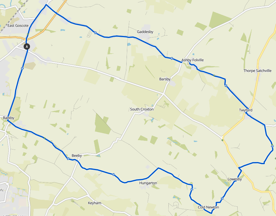
Barkby, Beeby, straight across the crossroads to Hungarton (regroup at Ashby Arms) and on to Cold Newton. Left before Sludge Hill to go to Lowesby, then a left right over the Melton R…
Week 14: Baggrave
A Group:
 52.3km / 32.5mi / 420m Elevation
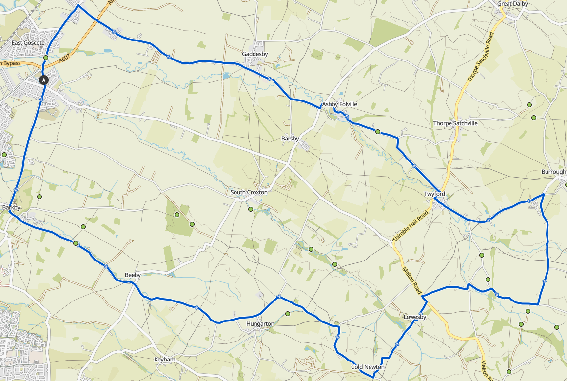
Week 13: Borough
A Group:
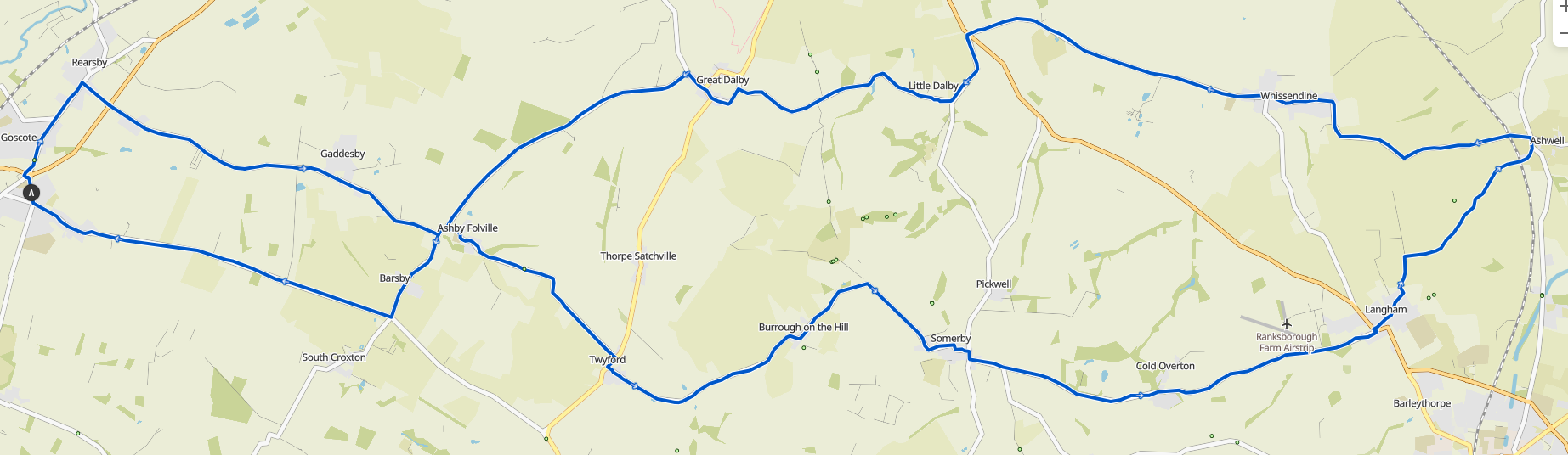 55.8km / 34.7mi / 420m Elevation
Somerby, Cold Overton, Langham, Ashwell, Whissendine, Little Dalby, Great Dalby, Ashby…
Week 12: Beacon
A Group:
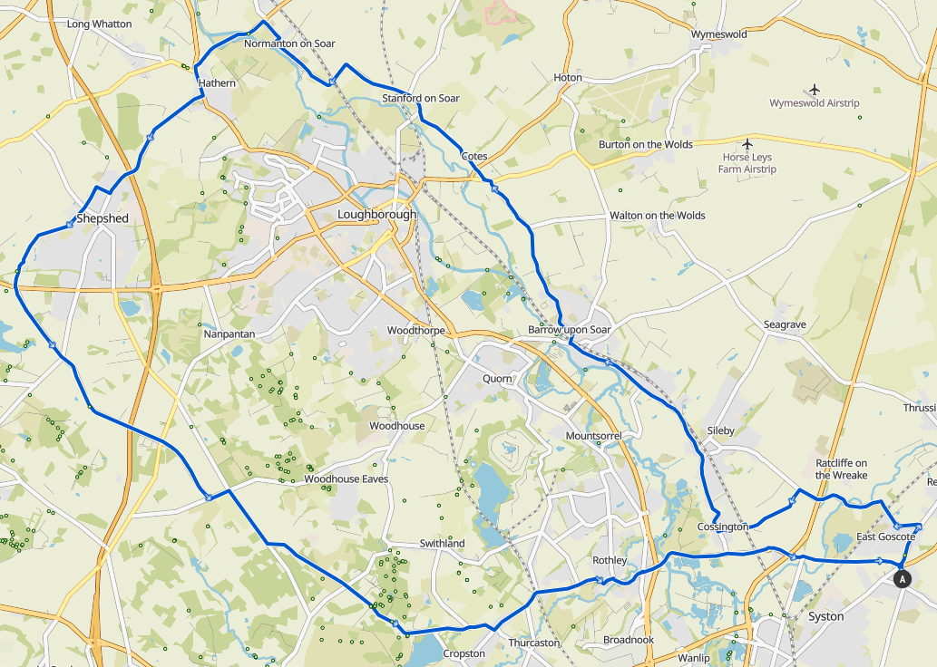 52.7km / 32.7mi / 380m Elevation
Stanford Lane into Stanford on Soa…
Week 11: Asfordby
A Group:
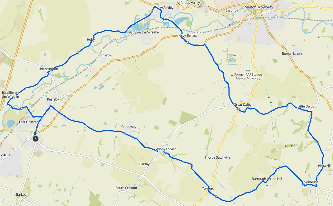 46.8km / 29.1mi / 300m Elevation
Week 10: Tilton
A Group:
 49.2km / 30.6mi / 410m Elevation
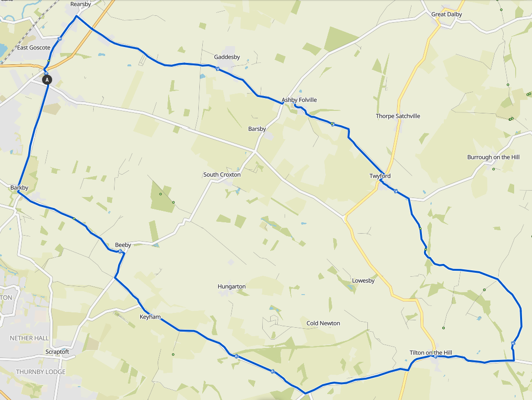
Week 9: Keyham
A Group:
 52.3km / 32.5mi / 420m Elevation
Week 8: Tilton
A Group:
 37.0km / 23.0mi / 260m Elevation
Week 7: Bash
A Group:
 42.4km / 26.3mi / 240m Elevation
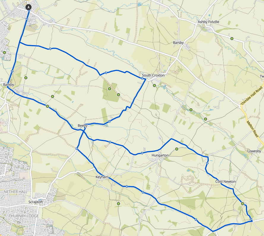
Week 6: Beeby
A Group:
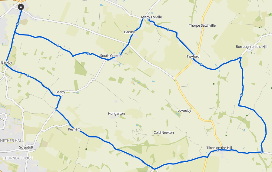 39.8km / 24.7mi / 360m Elevation
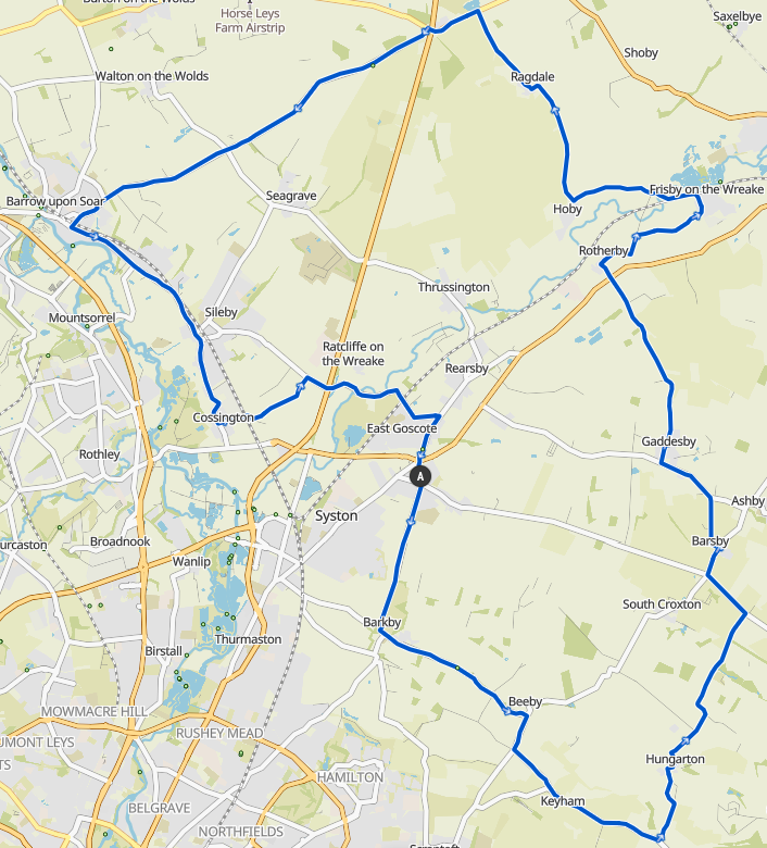
Week 1: Hoby Golf Flag
A Group:
 21.8km / 13.5mi / 120m Elevation
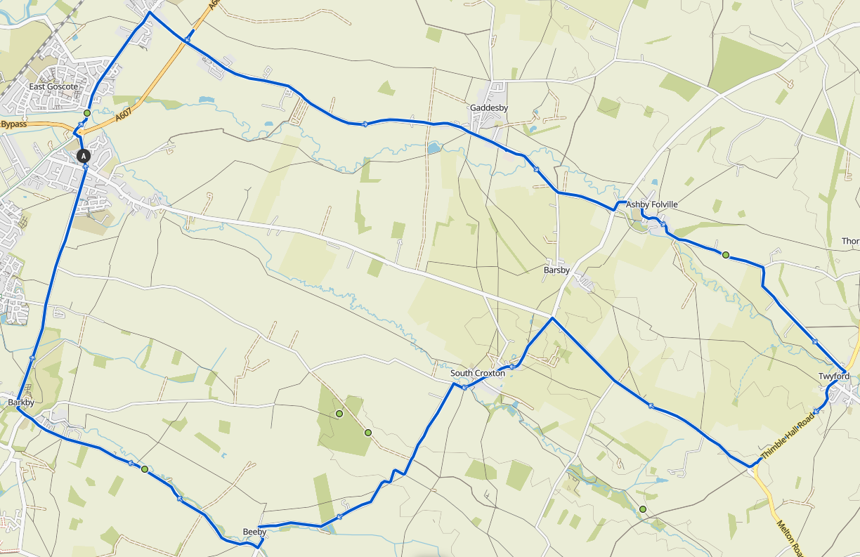
Week 2: Twyford
A Group:
 36.9km / 22.9mi / 260m Elevation
Week 5: Swithland
A Group:
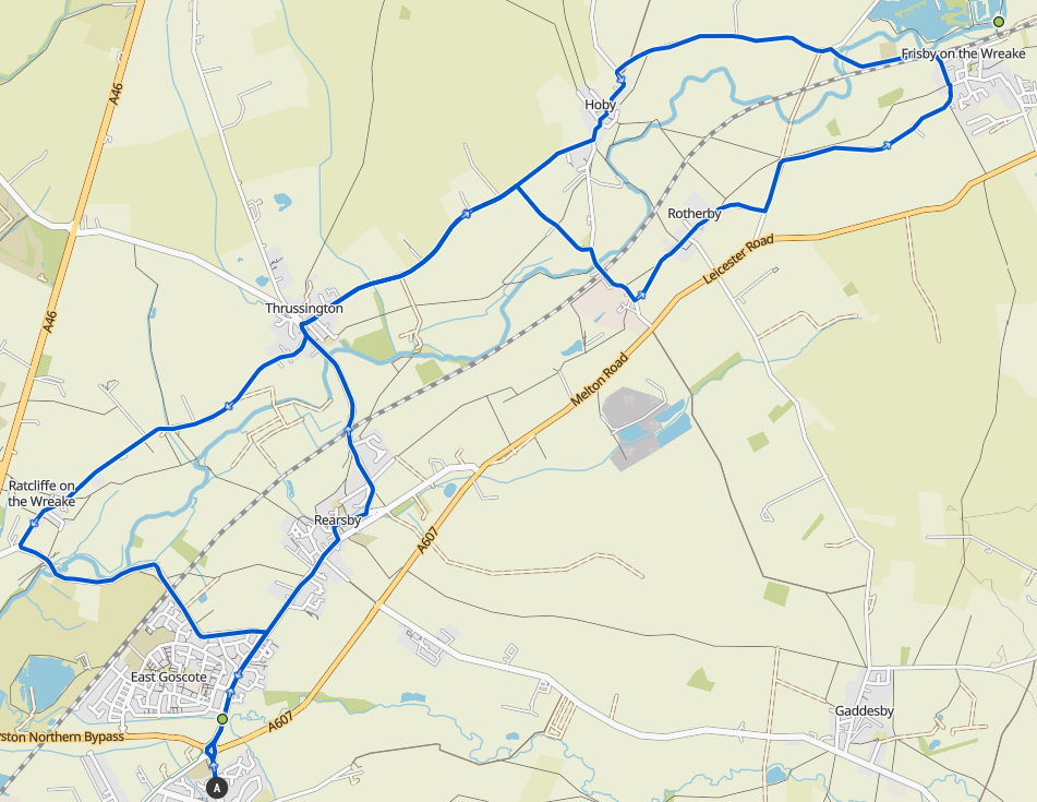
Week 3: Hoby
A Group:
 31.9km / 19.6mi / 190m Elevation
Week 4: Hungarton
A Group:
 30.4km / 18.9mi / 200m Elevation